
Published Wed 13th May 2026
Since 2016, specialists at Senceive have worked closely with Network Rail geotechnical engineers to monitor vulnerable earthworks and provide early warning of cutting and embankment slope failures.
Building the Foundation for Remote Monitoring
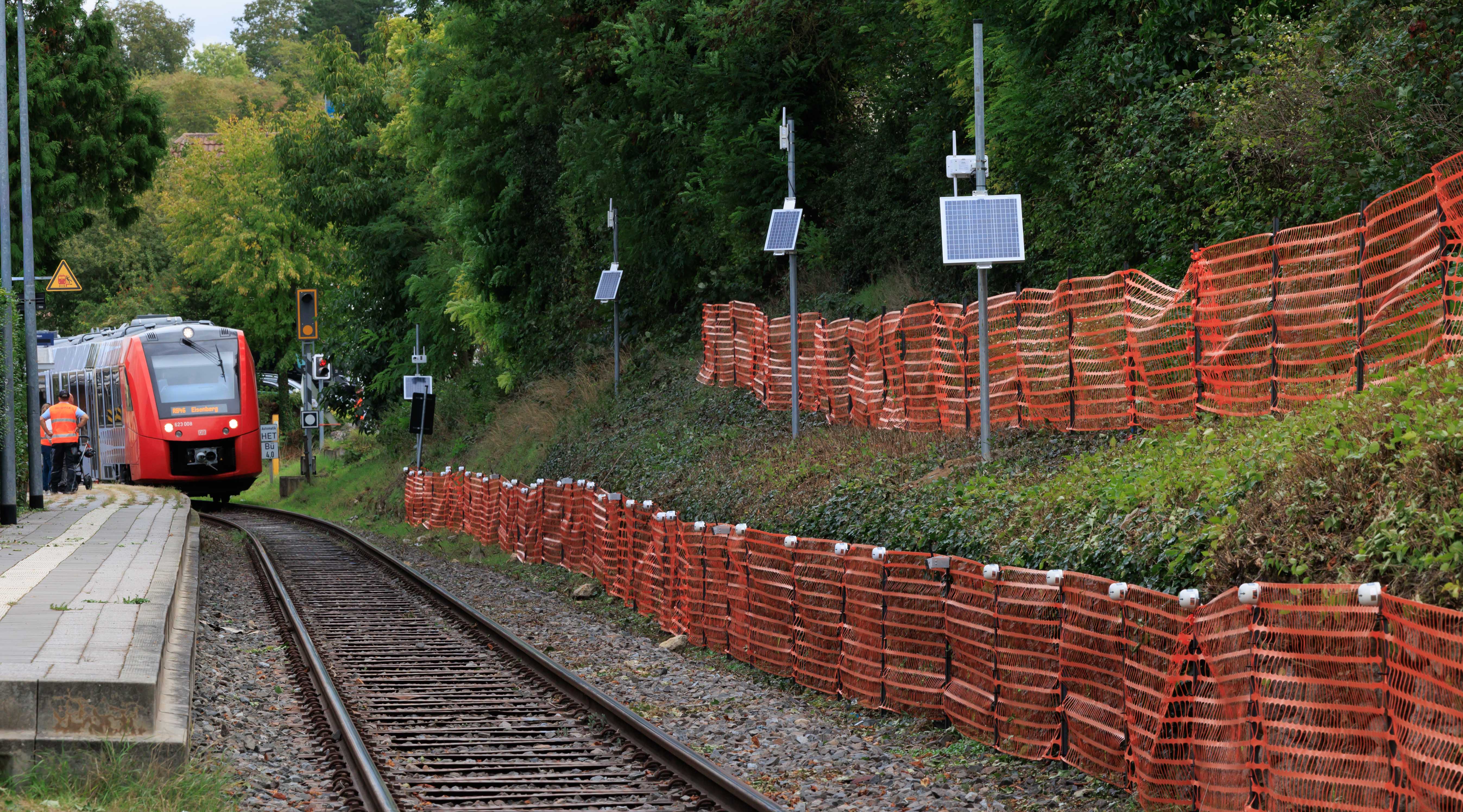
The initial solution centred on wireless tilt sensors mounted on metal stakes, designed to detect ground movement and send alerts via the mobile network. Early successes in the Southern Region, including deployments at Barnehurst and Wadhurst, demonstrated the value of real-time monitoring and led to wider adoption.
However, Network Rail quickly identified a critical need: the ability to visually assess the scale of an issue before engineers could reach site. This led to the development of an integrated camera solution.
Overcoming Rail Industry Challenges
Off-the-shelf camera systems proved unsuitable for the demanding rail environment. The solution needed to operate 24/7 without visible light that could distract train drivers, function without fixed power or communications infrastructure, and require minimal maintenance. Crucially, it also had to provide sufficient clarity to detect small objects (such as debris on the track) from a distance of up to 50 metres.
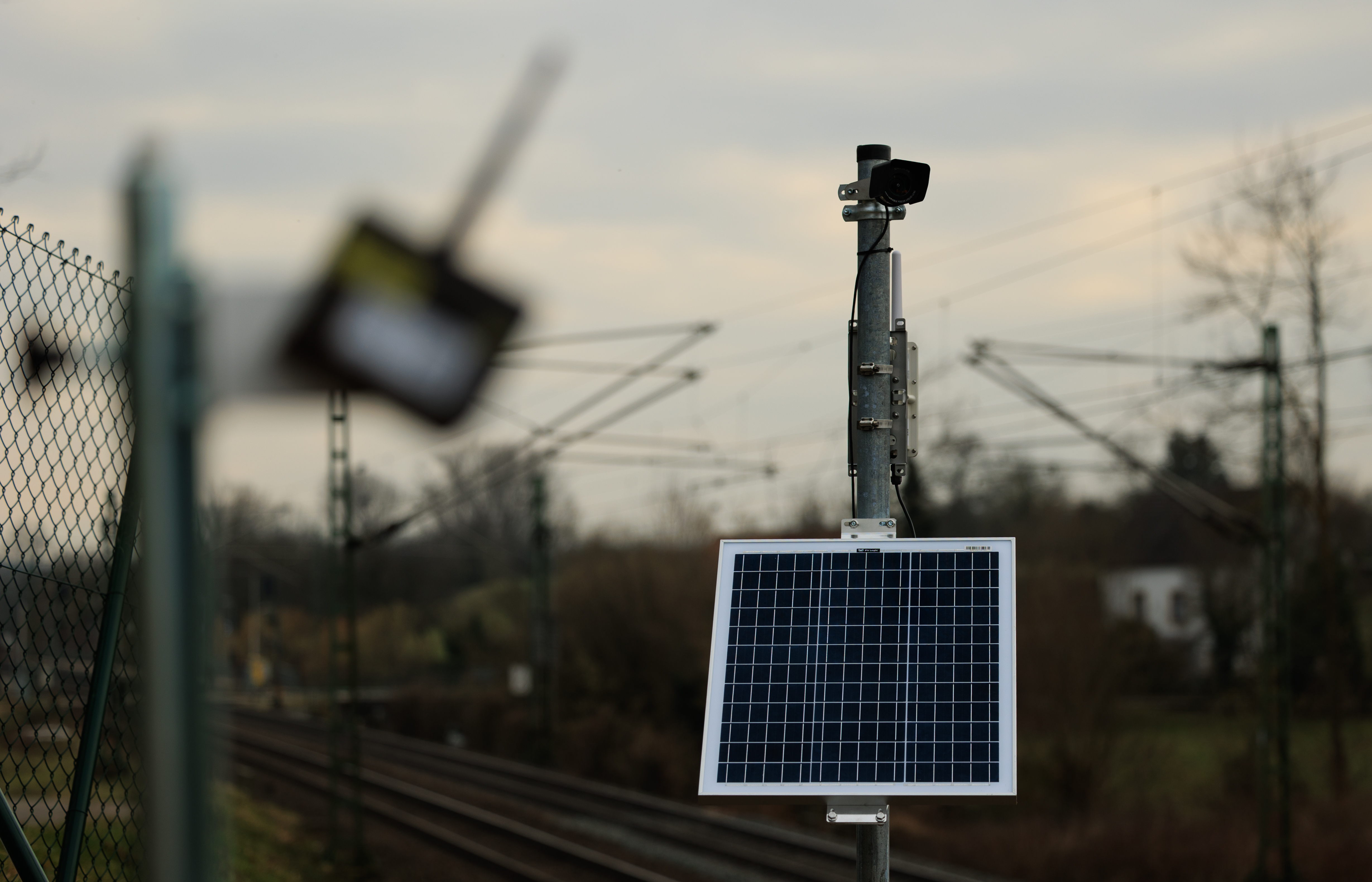
Senceive’s early camera system combined solar power with cellular connectivity and near-infrared illumination for night-time imaging. Significant effort was invested in optimising power consumption, edge computing, and image compression to ensure reliable performance even in areas with weak signal coverage.
Deployed from 2018, the system delivered scheduled and event-triggered monochrome images within minutes. This provided engineers with valuable visual context, enabling them to verify alerts and reduce false alarms thus minimising unnecessary and disruptive train delays.
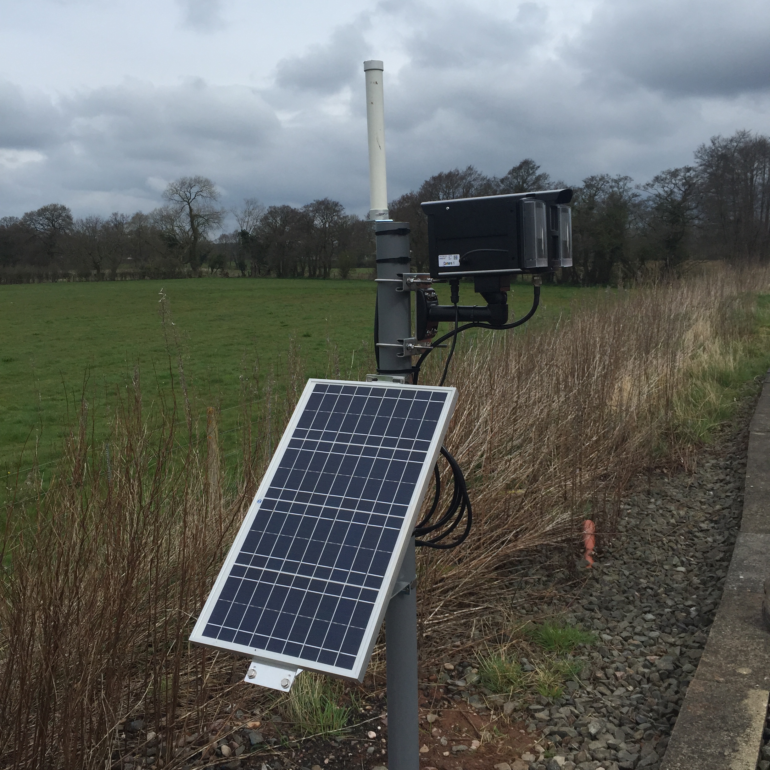
Earliest version of the FlatMesh Camera from 2018
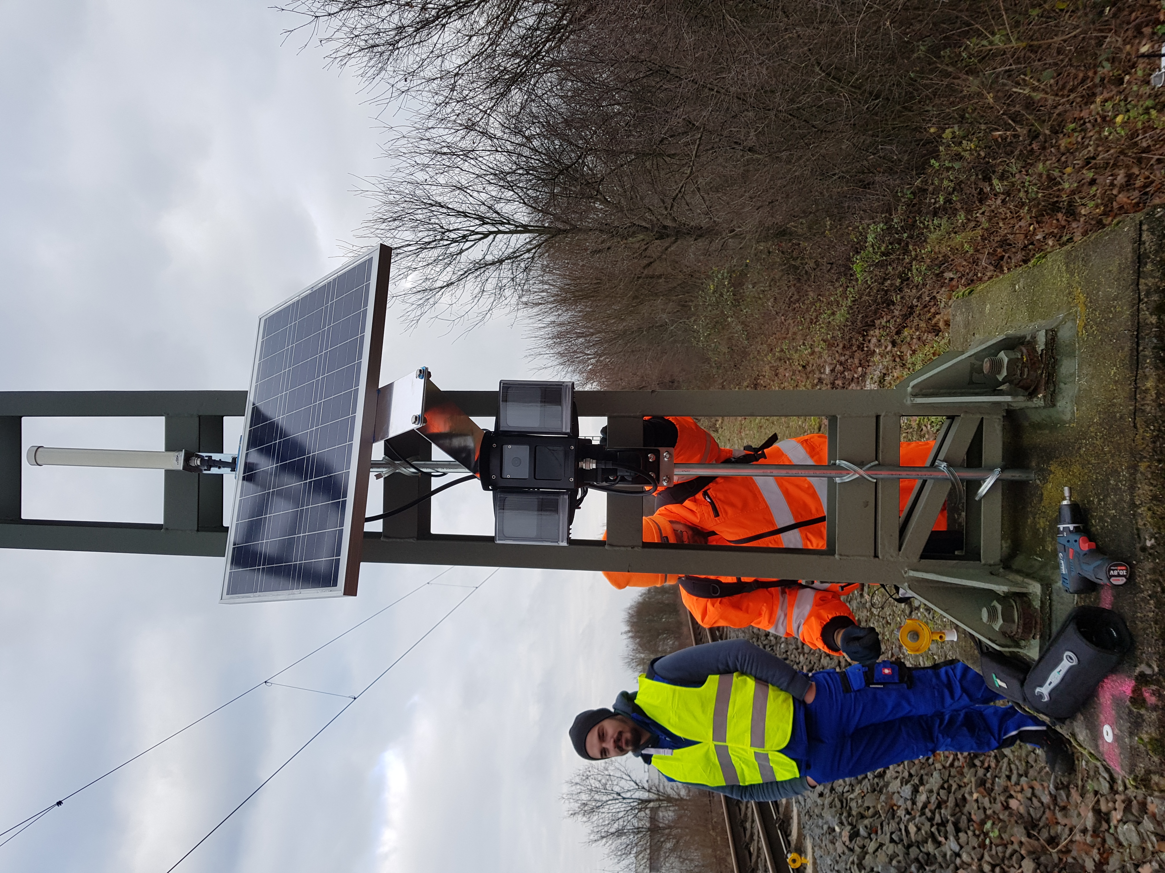
FlatMesh Camera from 2020
Continuous Improvement in the Field
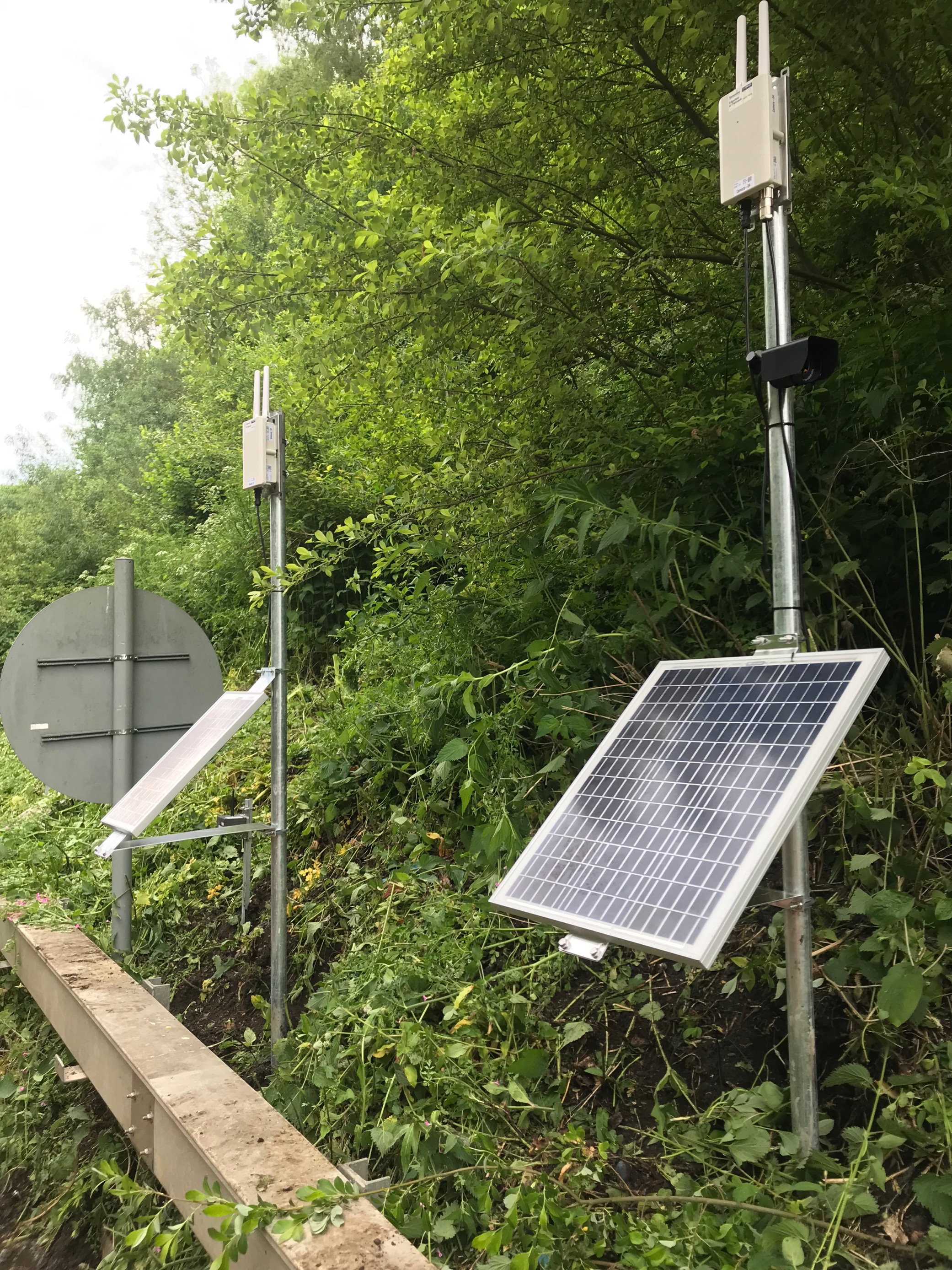
The introduction of remote imaging marked a major shift, reducing reliance on reports from train drivers or the public and improving situational awareness across sites in Kent, Sussex, and Wessex.
However, challenges remained. Night-time image quality could be inconsistent, with light sources such as signals or streetlights causing overexposure. Environmental factors like rain and condensation also impacted visibility.
Incremental improvements enhanced reliability over time, but a major breakthrough came in 2025.
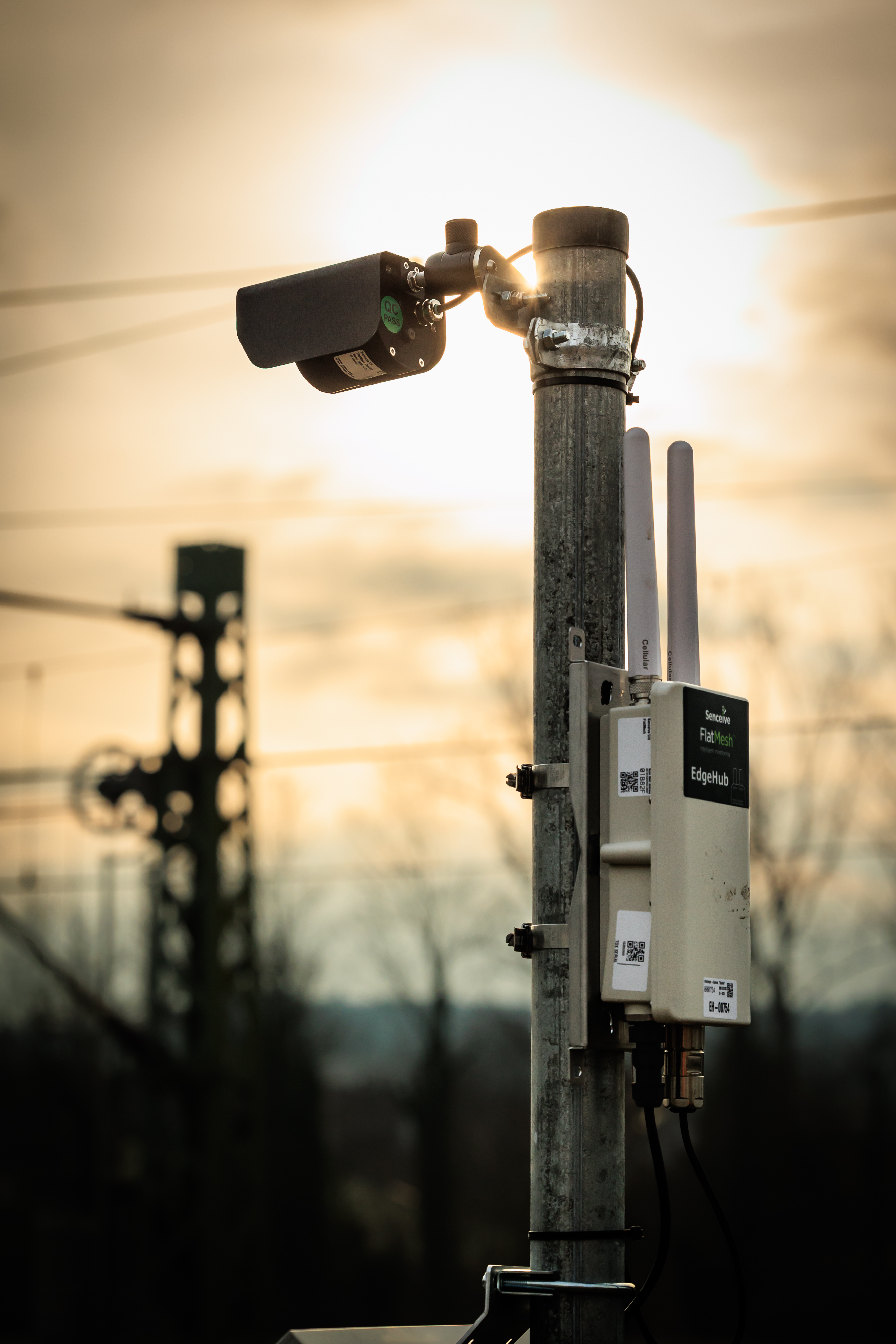
A Step Change with the FlatMesh CameraHub

Senceive CameraHub launched in 2025
The launch of the FlatMesh CameraHub represented a significant leap forward in remote monitoring capability. Designed specifically for harsh and remote environments, it delivers:
- High-resolution imagery up to 5MP without artificial enhancement
- Exceptional low-light performance for true 24/7 operation without external lighting
- Advanced lens cleaning technology for clear images in wet or dusty conditions
- A fully integrated solar-powered system with quick-swap battery packs
- Compact, modular design with LED diagnostics for rapid deployment and maintenance
Today, more than 1,300 camera systems are deployed across 600 UK rail sites, with additional applications in mining, rockfall monitoring, and bridge strike detection.
Enhancing Decision-Making in Real Time
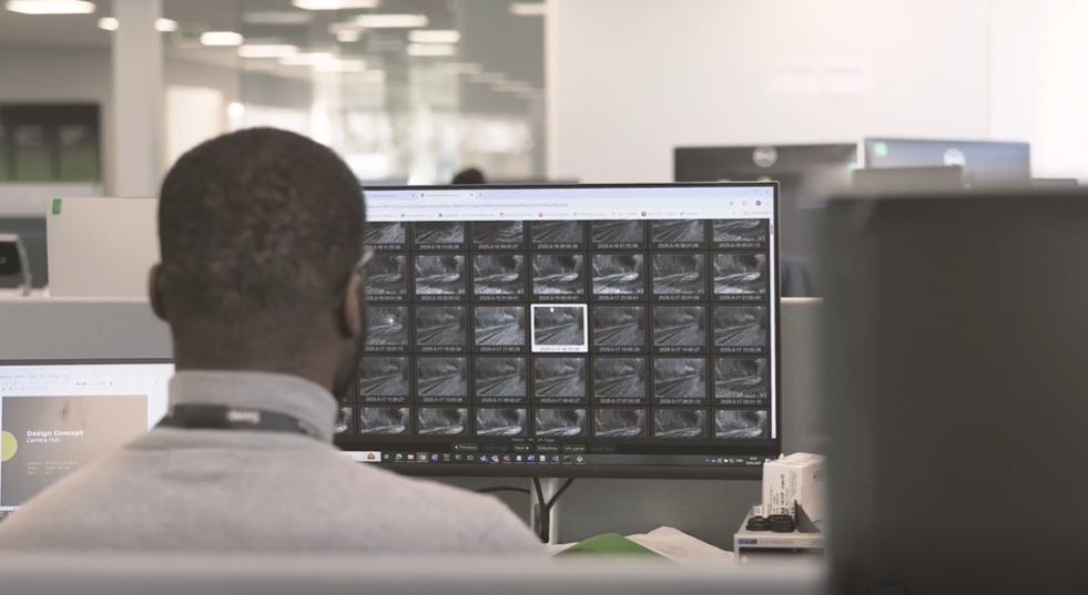
Senceive CameraHub image gallery offers an efficient way to interpret data alongside site images
Alongside hardware innovation, Senceive has advanced its data visualisation capabilities. A new image gallery within the cloud-based WebMonitor platform enables users to quickly access and interpret site imagery.
More recently, signal box portals installed along the West Coast Main Line allow signallers to view images of sites where ground movement has been detected - and even request new images in real time. This provides critical decision support in the moments before trains approach potentially hazardous locations.
From Supporting Tool to Standalone System
Innovation continues to push the boundaries of what remote monitoring can achieve. Users can now run time-lapse sequences to detect gradual change and apply AI-powered image analysis to identify risks such as rocks or debris on the track.
Importantly, alerts can now be triggered independently of tilt sensor thresholds, marking a significant evolution in capability.
What began as a tool to verify sensor data has developed into a self-sufficient remote sensing system capable of detecting, analysing, and communicating risk in real time.