






CameraHub captures geohazard events in Canada, helping keep transport networks safe
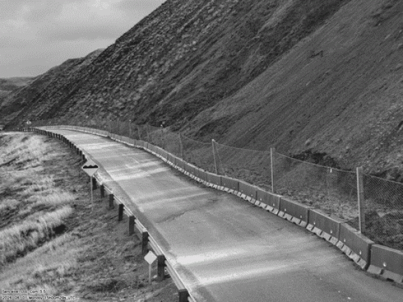
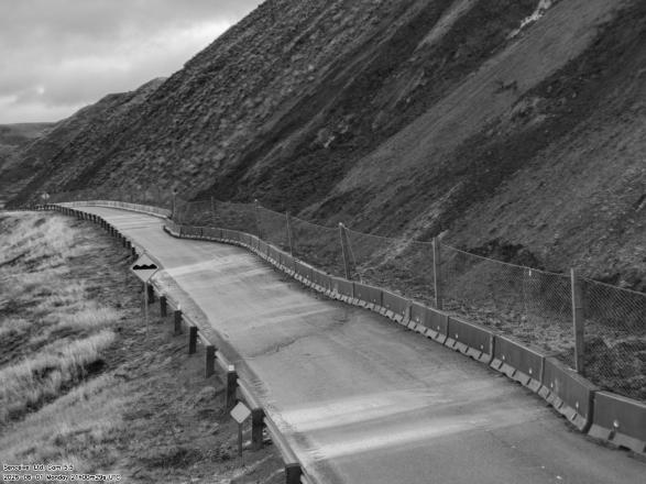
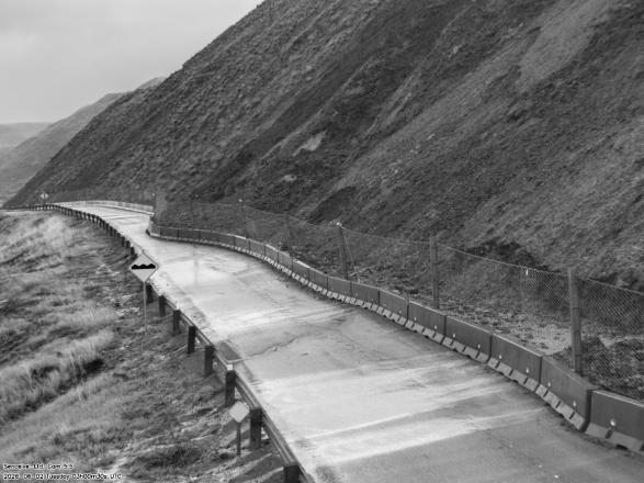
Recent monitoring projects in Canada have demonstrated the value of combining intelligent geotechnical monitoring with high-quality visual verification. Senceive’s CameraHub has successfully captured landslide, rockfall and other unexpected events, giving infrastructure operators the information they need to respond quickly and help keep railways and highways safe.
From a remote railway corridor to a rockfall-prone highway, CameraHub provides reliable imagery day and night, enabling engineers to quickly understand what is happening on site and make informed decisions.
Challenge
Remote railways and highways in mountainous and heavily wooded areas can be difficult and costly to inspect regularly. When ground movement, rockfall or other hazards occur, asset owners and operators need to know not only that something has changed, but exactly what has happened.
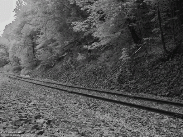
At one Canadian railway site, a heavily wooded embankment presented a potential risk to the railway below. Twenty wireless NanoMacro Triaxial Tilt Sensors were installed on metal stakes to continuously monitor slope movement, while a solar-powered CameraHub was deployed to provide visual oversight of the track.
At a separate location, a busy highway through mountainous terrain was exposed to ongoing rockfall and landslide risk. The challenge was to detect movement early and provide reliable information about events without relying solely on frequent inspections or extensive physical mitigation measures.
Solution
Senceive’s wireless monitoring technology was deployed to combine continuous sensor measurements with visual verification.
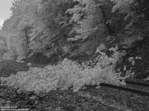
At the railway site, NanoMacro Triaxial Tilt Sensors monitor ground movement across the embankment, while CameraHub provides a visual view of the railway. During routine monitoring, CameraHub captured images of a fallen tree obstructing the track. The imagery allowed the issue to be identified quickly and the tree safely removed before it could pose a risk to passing trains.
At the highway site, draw-wire sensors and Triaxial Tilt Sensors were installed on the existing rockfall barrier, with additional Triaxial Tilt Sensors positioned on stakes across the slope. CameraHub was deployed to provide visual confirmation when an event occurred.
The system’s InfraGuard intelligent event detection was subsequently triggered by a landslide during the night. The change in sensor measurements automatically woke the monitoring system and triggered CameraHub to capture a sequence of high-resolution images. CameraHub was able to capture clear images in complete darkness without the need for illuminators, providing operators with immediate visual evidence of the event.
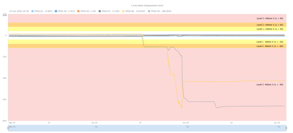
WebMonitor graph showing data from the landslide
By combining sensor data, automated alerts and imagery through WebMonitor, engineers could understand both the measured movement and the physical conditions on site.
Outcome
These Canadian projects demonstrate how combining intelligent monitoring with visual verification can significantly improve the response to unexpected events.
- Rapid identification of hazards: CameraHub captured a fallen tree on the railway and a nighttime landslide on the highway, providing clear evidence of what had occurred.
- Faster, more informed decisions: Sensor data and imagery gave engineers the information needed to assess events quickly and take appropriate action.
- Improved safety: The fallen tree could be removed before it threatened passing trains. At the highway, operators were able to close the road safely and implement mitigation measures before reopening the route.
- Reduced reliance on routine inspections: Autonomous monitoring provides continuous oversight of remote infrastructure, reducing the need for frequent site visits while ensuring visual evidence is available when conditions change.
- Reliable monitoring day and night: Solar-powered CameraHub delivers high-quality imagery in challenging environments, including during nighttime events, supporting long-term unattended operation.
These projects highlight the value of visual intelligence alongside geotechnical monitoring. Sensors can identify that movement has occurred; CameraHub helps show engineers exactly what has happened.
Designed for challenging, remote environments, CameraHub can operate autonomously for up to ten years using solar power and a long-life battery system. When combined with Senceive’s wireless monitoring and InfraGuard intelligent event detection, it provides infrastructure owners with actionable information when it matters most, helping them understand hazards quickly, respond safely and protect critical transport networks.
Created on: Tue 25th Aug 2026