Billings, Montana – Slope Stability Monitoring


Challenge
The Rimrocks, or the “Rims” are spectacular geological sandstone formations that surround the city of Billings – the largest city in the U.S. state of Montana.
Eighty million years ago this area was on the shore of the Western Interior Seaway – a sea that extended from the present-day Gulf of Mexico to the Arctic North. As water levels rose and fell they left behind sand, rocks and sediment before the eventual retreat of the Seaway . About a million years ago the Yellowstone River began cutting a canyon into the valley floor, crafting today’s landscape.
In the early 1900’s the Billings Bench Water Association Canal was built to provide residents and farmers with irrigation, and today it still plays a major role during the summer months, carrying water to farms and other water users primarily outside of the city.
In some of the areas where the canal runs directly at the bottom of the Rims, there have been slope stability issues. If a major slide were to occur, debris could easily block the flow of water, causing the level to rise over the banks and flood the neighborhoods below. In the past there have been various incidents of flooding, the most famous of which occurred in 1937, when the canal was breached and much of the downtown area flooded.
Solution
With the safety of the local residents as the top priority, the City of Billings sought a reliable early warning system to monitor movement of the slopes. Traditional monitoring methods for the site were considered, including automated survey and geotechnical instrumentation, but these would have required significant site work such as excavation, soil drilling, or poured concrete instrument foundations.
The City of Billings selected Senceive’s wireless tiltmeters as their preferred monitoring solution as the installation was quick and easy to deploy and allowed the project team to remotely set the network communications and geological monitoring parameters. The appeal of the system was also the ability for several agencies to remotely view the data on Senceive’s WebMonitor™ software, and to record real-time trends in slope displacement.
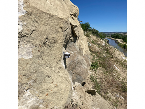
A total of 10 FlatMesh™ triaxial tiltmeters were installed in the area of concern. These sensors were installed on stakes, to assess ground stability, as well as directly onto large boulders. A Gateway and solar panel were installed on a pole across the canal, away from potential slope debris fall, ensuring reliable communication between the sensors and the WebMonitor™ data visualisation portal.
The system was initially configured to gather data every hour and to send automatic SMS and email alerts if movements breached certain thresholds. The InfraGuard™ feature was subsequently enabled so that detected movements automatically accelerate the reporting rate and provide early warning of significant events.
Outcome
The entire monitoring system was deployed by the client in less than a work day, providing public service agencies and local residents the assurance that future slope movement could be detected and reported quickly.
The City of Billings has observed a correlation between rainfall and small movements of the tilt sensors on stakes, allowing them to better understand slope behavior. The boulders have not shown significant movement trends. With long-life batteries that last for years, InfraGuard™ is an ideal long-term solution for detecting both incremental and sudden events. Long-term options include leaving the system in place through future winters when the canal is drained and continuing to monitor during the summer months, as well as during planned stabilization works.
Downloads
Created on: Thu 29th Sep 2022
The InfraGuard slope monitoring system is very turn-key and I’m impressed with the quality of the data. We have been very happy with the system and the service.
Key Points
- Slope stability issues below the Rims created a flood risk from a nearby canal
- With InfraGuard™, sudden movement can be detected, causing the sensors to accelerate their reporting rate to provide an early warning of a slide
- The array of 10 tiltmeters across the slope provides peace of mind during the summer months as well as slope movement data for future mitigation projects